A short trip to the headwaters of the Toba River
From the upper Elaho valley, four days were spent hiking across Clendinning Provincial Park and back through wild forest, mountains and glaciers
Document created 15 October 2006, last updated 28 October 2006

Hiking, backcountry skiing and even mountaineering alone, this is routine to me. To do so in grizzly country is more exotic, even though I have done it a few times before. But here, heading into Clendinning Provincial Park, that’s another matter. Between me and the alpine the untracked old growth forest stretches over 6 km as the crow flies, plus 1000 m of altitude gain. I do not expect to meet anyone. Once inside the forest I will be on my own, hoping for no mishap and, especially, no encounter with aggressive wildlife. These thoughts generate a sense of vulnerability that is holding me down now. Should I review my plans, go somewhere else? I do not have a great deal of trust in my deterrents, spray and bangers, to help deal with a really serious situation. On the other hand I know that the risk associated with bear, indeed the chance of seeing one, is minute. I have read extensively on the question and even discussed it with people with first hand experience of this kind of country. By far the greatest risk is terrain-related, but this is a fact I am used to disregard.


On the whole in this part of the forest the undergrowth is not too thick and does not make progress unpleasant. This changes markedly, although luckily not for too long, when reaching the first and largest of several little lakes in an area where the mountainside forms a wide plateau, near 1000-1100 m.

Beyond the plateau the undergrowth is often quite thick but progression is steady. A couple of streams provide scenic diversity as well as the welcome opportunity to re-hydrate. Higher up the forest cover opens up perhaps more gradually than I would have expected, and a number of beautiful tarns make this “sub-alpine” area very attractive.

A lake, near 1800m, is still largely frozen. After gaining a little more altitude I pitch my tent on a little snowy saddle, between two rocky outcrops which will provide excellent lookout spots. Looking down towards the valley, the plateau and its little lakes, midway up mountain, stretch in full view and the river beyond looks very far indeed. No wonder it took me about six and a half hours of almost continuous hiking to reach camp.


I had long been keen to visit Clendinning Provincial Park, discover its landscapes, immerse in its wilderness: this trip fully met my expectations. Thanks now to first-hand knowledge of the terrain new perspectives for more open-up, and my motivation is intact.
The car is reached at 3pm, nine and a half hours after start.
MAPS USED
Elaho to Meager Hiking Trail. Published by the Western Canada Wilderness Committee, May 2002 edition.
Clendenning Creek (92 J/5) and Mount Dalgleish (92 J/12). 1: 50,000. Produced by the Surveys and Mapping Branch, Department of Energy, Mines and Resources, Government of Canada, from aerial photographs taken in 1970.
Links to external websites:
[wb1] BC Parks website - British Columbia government website of all provincial parks, including Clendinning.
Comments
No comment available for this document
Ratings
Related documents Quick look
Below: the latest documents in
![]()
Open this category in Headlines for full navigation options and access to all categories and documents.
You can also use the navigation links located here in the right column.

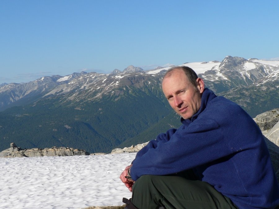
The Author Nicolas Chappaz

In the forest Some big trees are seen, 1.5m (5 ft) in diameter perhaps, but no real giant. On the whole in this part of the forest the undergrowth is not too thick and does not make progress unpleasant. Photo NC.

The lake on the forested plateau. There are several little lakes in an area where the mountainside forms a wide plateau, near 1000-1100 m.

Tarns near the alpine Nearing the alpine, the forest cover opens up perhaps more gradually than I would have expected, and a number of beautiful tarns make this “sub-alpine” area very attractive.

The Elaho valley seen from camp Looking down towards the valley, the plateau and its little lakes, midway up mountain, stretch in full view and the river beyond looks very far indeed. Photo NC.

Elaho-Meager junction The heads of the Elaho and Meager valleys merge into a broad basin looking almost like a lowland plain

Summit 7820 (western) In the morning I resume progression by heading towards summit 7820. Photo NC.

The true summit 7820 The main, north, summit is about 500m away across a wide gentle snow saddle. Photo NC.

View of Elaho Mountain From the summit the ridges appear gentle and should be easy to follow, at least for a good distance. Elaho Mt the high summit on the right. Photo NC.

Clendinning Creek For the first time I get a good view of Clendinning Creek’s valley, a deep and steep-sided glacial trough stretching far into the north-west. Photo NC.

Icefield Once up on the other side a wide expanse of snow, almost an ice field, opens up. I make my way just above a series of thin crevasses to a small summit, about 7400’, crowned by a flat rocky area. Photo NC.

Elaho Glacier From camp the Elaho Glacier is visible, with the Manatee Group in th background. Photo NC.

Mystery Summit Could this be Waddington? It is very far, in exactly the right direction, and stands out abover everything else. Photo NC.

Balanced rock Walking down towards Elaho Glacier, beautifully balanced huge granite blocks. Photo NC.

Walking down to the Elaho Galcier On the Elaho Glacier's right bank the slopes are very steep and mostly made of scree and boulders. The forest colonises every more level or sheltered area.

Indian paintbrush Indian paintbrush flowers in the debris slopes above the glacier.

Elaho Glacier tongue General view of the glacier's tongue, with Manatee summits in the background. Toba headwaters just behind the saddle in the shade.

Glacier flats This level area provides fairly safe and easy access to the moraine on the other side (left bank). Some ice mound features are visible in the foreground.

Ice mounds Sharp mounds of ice, up to 1 metre high approximately, covered with a thin layer of sand. Note how the glacier's surface around is bare.

Elaho River heads The Elaho River flows between ice cliffs as out of a canyon.

Saddle close-up Looking south-west across the saddle towards the upper Elaho Glacier and the Clendinning summits on its right bank.

Saddle lake One of several small lakes on the saddle, here on the Elaho side with the upper glacier's tongue and side summits in the background.

Toba headwaters On the saddle's north side, the small lakes are the uppermost headwaters of the Toba River.

Toba valley View of the valley from the saddle's high point. In contrast with the Elaho side, here the valley is completely forested up to the saddle.

Moraine flowers Many flowers add a variety of colours to the side moraine's bleaker colours.

Glacial streams Later, in the heat of the day, melting surface ice forms a maze of little streams often ending up in holes (moulins) that go right through the glacier's thickness and down to the sub-glacier's stream.

Glacier retreat Near the Elaho Glacier's snout, a side glacier has retreated up-slope, leaving bare rocks in its former bed. The side moraine is clearly visible on the right. As a result the Elaho Glacier's right side is no longer fed with ice and may in time disappear.

The way back to camp Back across the Elaho Glacier, a 3000 vertical feet gain up debis slopes then on snow leads back to camp.

Camp This gentle 7400' summit overlooking both Elaho and Clendinning valleys provides a sheltered area for camp. Icefield behind to the south-east with the Pemberton Icefield in the distance.

Hanging lake Hundreds of metres below camp, this lake at the end of a glacial tongue hangs precipitously above the Clendinning valley.

Sunrise on the ridges Clendinning-Sims Creek divide mountains (Clendinning Creek's right side) in the rising sun.

Morning light in the Clendinning Valley Sunlight makes a bright cover to the valley's remaing darkness.

Icy lake Passing by the icy lake, about 1800m (6000'), on the way back down to the Elaho Valley.

Forest bridges Fallen trees help cross gullies and streams.
×